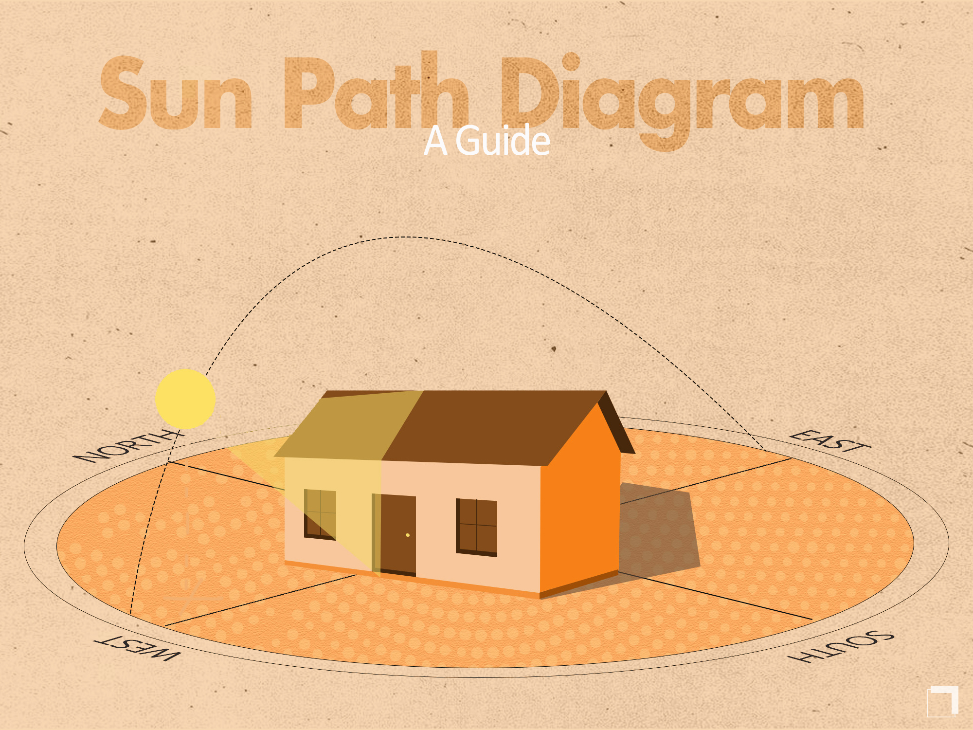
Simple Method to Read Sun Path Diagrams in Architecture
Designing projects for a tropical country, especially like India, considering the angle and path of the sun is extremely important for apt solar-powered designs. It is even more necessary to understand how to read the path of the sun so that solar panels can be oriented in the right direction.
But at first glance, all we can see is a circle with complicated lines in it. And even if we are able to read the sun path diagram correctly, we might now know exactly what and where to use the information.
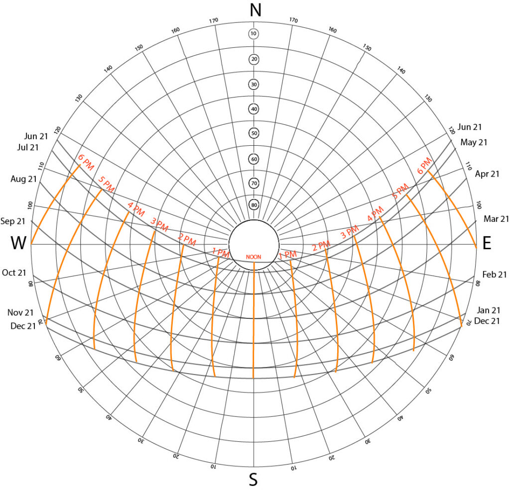
Sun Path Diagram
Here's a step-by-step guide to reading and using the information provided by a sun path diagram:
Identify the curves which depict months
Identify the curves which depict time
Intersect
Find the altitude of the intersection
Find the Azimuth angle of the intersection
Find sun's position at any time of the day for a given month
How To Read The Sun Path Diagram
The following are represented in a sun path diagram:
Month Curves
Time Curves
Altitude Circles
Azimuth Lines
The Month Curves
The Months Curves
Inside the circle, you will find seven concentric and horizontally curved lines. Each line represents two months each because the sun is almost at the same positions at those times.
The pairs are May and July, April and August, March and September, February and October and January and November. June and December, when the sun is at its highest and lowest positions respectively, have their own lines.
The first step in reading a Sun path diagram is to identify the line that represents the month you want to study for your project.
The Time Curves
The Time Curves
The next step is to identify the time curves.
These are the slightly bulging vertical lines which intersect the month lines.
The centermost line represents noon or 12 PM.
In order to determine the position of the sun during the given month and time, you have to find the intersection between the two lines. For example, if you want to know the position of the sun during 1 pm in January, mark the intersection between the two lines.
From this, we can determine both the altitude of the sun and the azimuth angle.
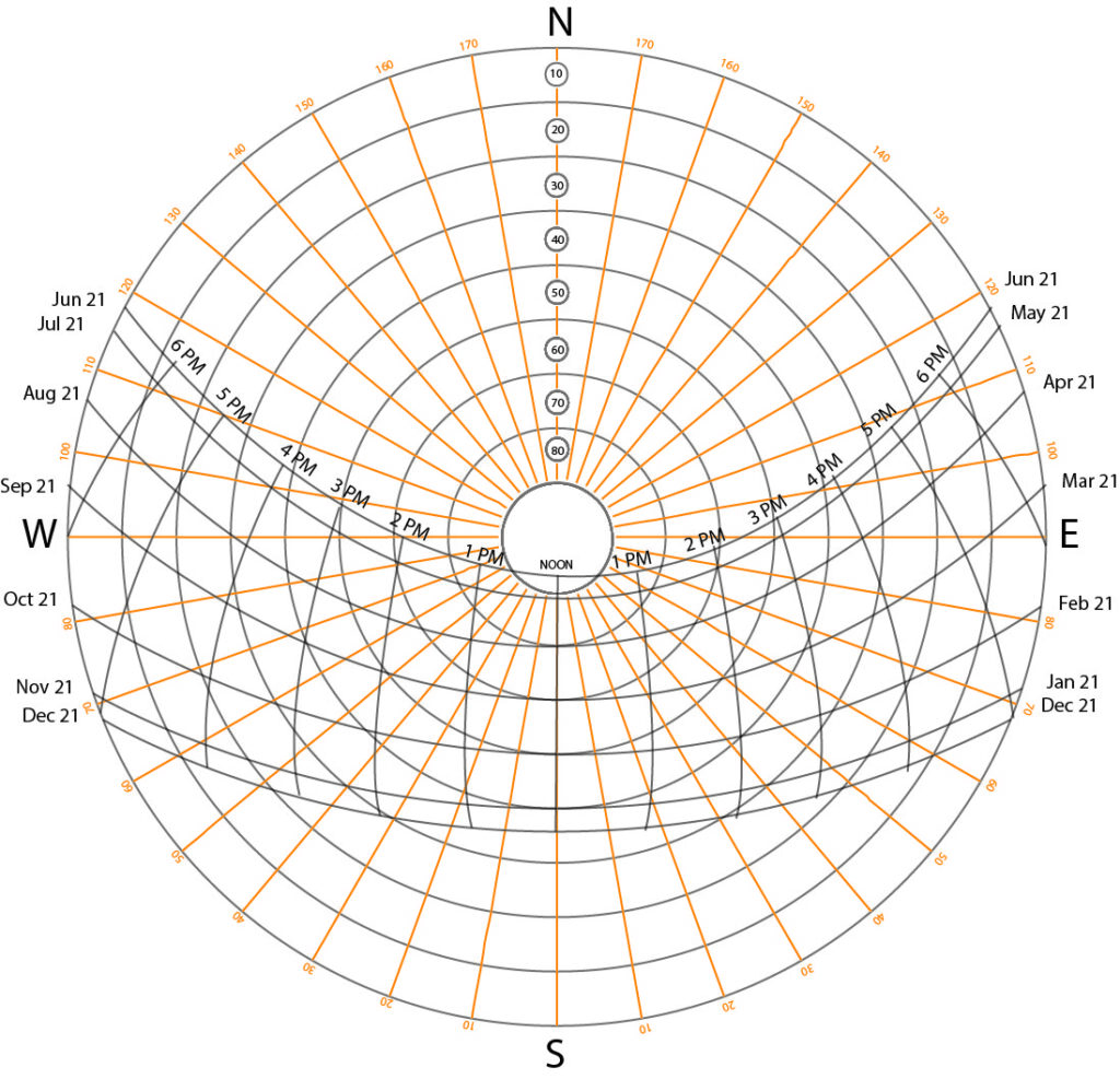
The Altitude Circles
The Altitude Circles
The Sun's altitude is its height from the horizon when it rises.
It starts from 0 degrees when it rises.
The higher the sun, the higher its altitude and higher the angle.
Take the intersection of the months and the time curves. If it intersects the circles of angles which are exactly 10 degrees, 20 degrees, 30 degrees and so on, then well and good. But in the case that it doesn't, which is very likely, you will have to draw your own concentric circle and measure the angle in between the lines (like 26 degrees, 48 degrees etc.).
The Azimuth Lines
The Azimuth Lines
The azimuth angle is the angle of the sun from a reference point, which is usually North (0 degrees).
With reference to this, the other points are East (90 degrees), South (180 degrees), West (279 degrees).
The Azimuth angle lines are the lines radiating to the circumference of the circle from the center for every 10 degrees. To find the Azimuth angle, draw a line from the center of the circle to the circumference, passing through the time and month intersection point. For example, if the line hits 120 degrees, then the Azimuth angle of the Sun at that hour would be 120 degrees from the North point.
What can I do with this info?
Now we come to the important part- what exactly is the use of finding the altitude and the Azimuth angle of the Sun?
The Sun path diagrams are from the point of view of the sky, looking down directly at the ground. So for a given location, the Sun path diagram can determine the position of the sun throughout the year, at every single hour.
This means we can easily study when and where sunlight will be falling at a particular time while designing.
This enables us to design climate-responsive spaces since we know how the sun will affect our site and building throughout the year. This is the functional part.
Studying the Sun's movement on the site can also help with the aesthetic part of a design by making maximum use of the natural light and enabling interesting play with shadows.
Websites And Software For Getting Sun Path Diagrams
Climate Consultant: Download the EMP file of the city and load it in Climate consultant software to get the sun path diagram.
AndrewMarsh.com Enter the location of your site to load the sun path diagram.